Table of Contents
The Faridabad Master Plan 2031 serves as a visionary document that outlines the strategic framework for the sustainable development of Faridabad, a rapidly growing city in Haryana, India. Approved by the government, this comprehensive plan aims to address the city’s evolving needs and challenges while ensuring a better quality of life for its residents. In this blog post, we will delve into the details of the Faridabad Master Plan 2031, highlighting its key features and implications for the city’s future.
Population
The city of Faridabad, which is situated in the Indian state of Haryana, has a detailed development plan called the Faridabad Master Plan 2031. The predicted population expansion was one of the key elements considered when creating this master plan. Let’s look at the Faridabad Master Plan 2031’s population section to see how it addresses the benefits and difficulties brought on by the city’s growing population.
· Current Population and Growth Trends
According to the most recent data, there are roughly 1.5 million people living in Faridabad. However, the city is seeing tremendous population increase, much like many other Indian cities. This is taken into account in the Faridabad Master Plan 2031, which strives to successfully manage the anticipated population growth in a planned and sustainable manner.
· Population Growth Projected
According to the master plan, Faridabad’s population would dramatically rise by the year 2031. Although exact numbers may vary, it is anticipated that there may be several million people living there. For the city’s infrastructure, urban services, and quality of life, this increase brings both opportunities and challenges.
· Addressing Infrastructure Challenges
According to the master plan, significant infrastructure development is required to support the growing population. It contains plans to upgrade road networks, widen streets, and boost connection both inside and outside the city. The plan places a strong emphasis on the necessity of creating effective and sustainable transport networks to meet the demands of the expanding population.
· Housing and Residential Areas
There is a demand for suitable housing options due to the growing population. The construction of residential zones that can accommodate various income levels, including alternatives for inexpensive housing, is emphasised in the Faridabad Master Plan 2031. It helps to create planned, inclusive, and sustainable residential neighbourhoods by locating suitable land parcels for housing projects.
· Social Infrastructure and Amenities
The master plan places a strong emphasis on the creation of social infrastructure and amenities in order to provide a good quality of life for the expanding population. Providing educational institutions, healthcare facilities, recreational areas, and community centres is included in this. To meet the population’s changing requirements, the plan recognises the need for more schools, hospitals, parks, and cultural venues.
· Workplace opportunities and economic expansion
As the population increases, so does the need for employment and expansion of the economy. The Faridabad Master Plan 2031, which aims to spur economic growth by enticing investments, expanding industries, and fostering entrepreneurship, acknowledges this. The plan identifies areas for industrial and commercial development, creating a conducive environment for the creation of jobs and economic prosperity.
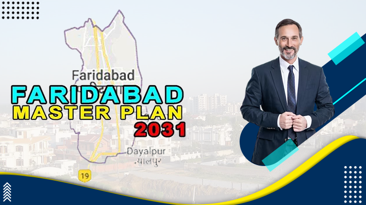
Map
The Faridabad Master Plan 2031 map provides a detailed depiction of the city’s planned growth, land use, infrastructure, and numerous zones with varying uses. It offers a visual representation of the city’s future by emphasising key locations, road systems, transportation hubs, green spaces, and other crucial aspects.
• Land Use and Zoning:
The master plan map prominently displays the land use and zoning pattern. It delineates many zones, such as open spaces, institutions, commercial, industrial, and residential ones. One can determine how land is allocated and assigned for particular uses by looking at the map, ensuring efficient and sustainable urban expansion.
• Road Networks and Transportation:
The master plan map shows the key highways, existing and projected, as well as the current and proposed road networks. The city’s links to surrounding areas, planned ring roads, arterial roads, and transportation hubs are highlighted. The city’s transport system and long-term development goals are easier to comprehend thanks to this visual portrayal.
• Green Spaces and Recreational sites:
The map also draws attention to the fact that Faridabad has parks, green spaces, and recreational sites. It demonstrates the city’s dedication to protecting and developing the environment by giving locals access to open places for enjoyment and ecological balance.
• Infrastructure and Utilities:
The map shows the planned infrastructure projects. Infrastructure development is an important component of the master plan. It displays the locations of planned utilities such sewage systems, power distribution networks, waste management facilities, and water supply systems. Stakeholders and locals can better comprehend the city’s planned infrastructure thanks to this visualisation.
• Growth Centres and Development Areas:
The map shows where development and growth are concentrated in Faridabad. These places represent potential growth hotspots for business, housing, and industry, luring capital and creating job possibilities. Stakeholders can learn more about the city’s economic prospects and plans for urban expansion by examining these designated regions.
• Environmental conservation and heritage sites:
The Faridabad Master Plan 2031 includes the preservation of natural resources and cultural heritage. Green belts, historical places, and ecologically significant regions are marked on the map. The city’s dedication to protecting the environment and preserving its rich history for future generations is illustrated by this visual portrayal.
Economic Base
The Faridabad Master Plan 2031 acknowledges the significance of expanding employment opportunities and diversifying the industrial base to support economic growth. Manufacturing, engineering, autos, textiles, electronics, and information technology are among the areas the plan highlights as needing development. The plan intends to build a varied and robust economic base by luring investments and encouraging a positive business climate.
• Zones and clusters of industries:
The master plan defines some locations as industrial zones and clusters to support industrial expansion. These areas offer the utilities, support systems, and infrastructure required to promote the formation and growth of industries. The creation of industrial estates, special economic zones (SEZs), and industrial corridors is emphasised in the plan as a means of fostering the growth of firms.
• Promotion of Small and Medium Enterprises (SMEs):
The Faridabad Master Plan 2031 places a strong emphasis on fostering the expansion of SMEs, acknowledging their crucial contribution to economic growth and employment generation. The plan offers methods for offering SMEs the infrastructure, funding, skill-development programmes, and technological support they need to thrive and strengthen the city’s economic foundation.
• Retail and commercial development:
The master plan places a strong emphasis on the expansion of the commercial and retail sectors in addition to industrial growth. It points out locations that are excellent for the construction of commercial centres, shopping centres, office buildings, and lodging facilities. The strategy is to establish thriving business areas that draw investments, present job opportunities, and support the general economic development of Faridabad.
• Information Technology (IT) Parks and Knowledge Parks:
The master plan supports the growth of IT parks and knowledge parks to promote innovation and knowledge-based enterprises. These hubs offer a platform for entrepreneurs, technology-driven businesses, and research & development. Faridabad wants to become a centre of innovation and draw high-value jobs by fostering an ecosystem that is favourable for knowledge-based enterprises.
• The economic foundation of the Faridabad:
Faridabad Master Plan 2031 is focused on creating employment possibilities for the city’s expanding population. The plan acknowledges the value of skill development initiatives and vocational training to raise workforce employability. To close the skills gap and develop a qualified workforce that can fulfil the demands of industries, it places a strong emphasis on partnership with educational institutions, business associations, and training facilities.
• Infrastructure to Support Economic Growth:
According to the master plan, a strong infrastructure is required to support the country’s economy. This entails the creation of logistical centres, power supplies, water management systems, and connectivity with nearby regions. The strategy makes sure that the necessary infrastructure is in place to support trade, encourage industry, and draw in investment.
Extension of Urbanizable Proposals
According to the Faridabad Master Plan 2031, urbanisation would also affect lands to the east of the city (the road leading to Gurgaon), south of the city (the village of Jharsentli), and southwest of the city. It is crucial to remember that topographical constraints and legal restraints prevent some regions from becoming fully urbanised.
In accordance with the master plan, 24 km of the western side of the land has already undergone urbanisation. Because it is located in the environmentally sensitive Aravali range, further development in this area is restricted. For ecological harmony and environmental conservation, the Aravali range must be preserved.
Furthermore, the border between Delhi and Haryana prevents considerable development in the northern part of Faridabad. This border serves as a control point, preventing further urbanisation in that area.
Given these limitations, the Faridabad Master Plan 2031 places an emphasis on maximising the amount of land accessible for urban expansion while also giving environmental sustainability and the preservation of natural resources top priority. It emphasises the necessity of effective land use and the construction of infrastructure in locations that are doable and consistent with the master plan’s overarching objectives.
The master plan may place a strong emphasis on redeveloping and revitalising existing urban districts, upgrading infrastructure, and raising resident quality of life in order to ensure sustainable urban expansion. Additionally, it might support the development of recreational areas, encourage the preservation of green spaces, and safeguard the natural balance in inaccessible areas like the Aravali range.
The Faridabad Master Plan 2031 seeks to achieve a balance between urban expansion and environmental preservation by overcoming these topographical constraints and legal restrictions. It makes sure that the city’s growth is guided by sustainable ideals, providing a better living environment for its citizens while preserving Faridabad’s ecological integrity and natural heritage.
Stakeholders, policymakers, and the community must collaborate as the plan develops to guarantee that the strategies of the master plan are implemented successfully. The realisation of a thriving, sustainable, and inclusive Faridabad that balances urban growth with the surrounding environment will be made possible thanks to this cooperative effort.
Proposal of Extent of Various Land Uses
Taking into account the total town density and the anticipated population development, the Faridabad Master Plan 2031 offers suggestions for various land uses. The plan proposes to house about 38.86 lakh (3.886 million) individuals within the urbanizable regions covering 34,368 hectares by 2031. To promote a balanced and sustainable urban environment, these areas have been set aside for a variety of land uses.
Following is a breakdown of land use in the Faridabad Master Plan 2031:
• Residential:
To accommodate the expanding population, the plan allots about 14,328 hectares (41.69%) for residential use.
• Commercial:
2,069 hectares (6.02%) are set aside for commercial uses, which include office buildings, malls, and business centres.
• Industrial:
To support job creation and economic growth, the plan reserves 6,179 hectares (17.98%) for industrial development.
• Transport & Communication:
A total of 4,020 hectares (11.7%) are set aside for facilities related to transport and communication, enabling seamless connectivity within and outside of Faridabad.
• Public Utility:
The plan allots 638 hectares (1.86%) for services like power distribution, sewage systems, and water supply.
• Public and Semi-Public Uses:
Around 1,299 hectares (3.78%) are set aside for public and semi-public uses, which include educational institutions, healthcare facilities, community centres, and administrative buildings.
• Open Spaces, Parks, and Green Belts:
The master plan places a strong emphasis on the value of green spaces and open spaces by designating 5,314 hectares (15.46%) for parks, open fields, and green belts. These regions encourage environmental preservation and raise the standard of living.
• Special Zone:
448 hectares (1.30%) of the overall area have been classified as special zones, which may include regions with strategic value or sites for particular construction initiatives.
• Mixed Land Use:
Within designated zones, a limited area of 73 hectares (0.21%) permits a combination of residential, commercial, and recreational activity.
The Faridabad Master Plan 2031 aspires to provide a well-planned and sustainable city that meets the requirements of its citizens, promotes economic progress, and protects natural resources by allocating land for varied uses. The plan’s all-encompassing approach to land use assures effective use of the existing space while taking Faridabad’s expected population growth and urban expansion into account.
Residential land in Faridabad Master Plan 2031
Given the anticipated population growth, a sizeable area for residential units of 14,328 hectares has been set aside in the Faridabad Master Plan 2031. A plan of 300 individuals per hectare on average has been taken into consideration to handle the growing population. To accommodate the workers in those locations, a greater density proposal of 600 people per hectare has been made for areas close to industrial districts.
A balanced distribution of housing options will be ensured by the exclusive approval of group housing developments in some sectors, including 119, 143, and 146. High-density residential zones with a density of 1,125 people per hectare have been designated in sectors 99, 112, 119, 122, 139, 143, 146, and 156 to meet the demands of low- and middle-income groups. This makes it possible to build more cheap homes and smaller flats.
In proposed residential sectors, extra infrastructural areas would be supplied to satisfy the needs of various population segments. This includes providing necessities like electricity, roads, water supplies, sewage systems, and other services. Additionally, the master plan stipulates that the breadth of the property should be at least 12 metres wide to ensure sufficient road networks and accessibility within the residential areas.
The Faridabad Master Plan 2031 also highlights the value of parks and green areas in residential neighbourhoods. Parks should have a minimum area of 2.25 square metres per person to allow for enough open space for relaxation, recreational activities, and the promotion of a healthy lifestyle.
The Faridabad Master Plan 2031 seeks to develop well-planned and sustainable residential zones by taking into account these suggestions and directives. The distribution of particular densities, emphasis on inexpensive housing, supply of infrastructure, and the addition of green areas all work together to improve Faridabad’s general livability and quality of life for its citizens.
Commercial land in Faridabad Master Plan 2031
An area of 2,069 hectares has been designated for commercial use in the Faridabad Master Plan 2031. To prevent residential buildings from being turned into commercial ones, the plan deliberately specifies commercial land uses along sector roads. Commercial sectors have been designated particularly as sectors 100, 120, and 154.
Further prospects for commercial development will be provided by the conversion of sectors 20A and 20-B from public to commercial usage. Additionally, a few sectors, including NH44 (Delhi-Mathura Road) corridor, 27A, 27B, 27C, 27D, 32, 35, and 36, will be converted for commercial use. It is crucial to remember that any land in these sectors that was originally designated for industrial uses can only be transformed into commercial land with the authority’s approval.
HUDA (Haryana Urban Development Authority) development is the only permitted use of Faridabad’s commercial sectors 100 and 117-A, underscoring the need of carefully designed and organised commercial spaces.
In order to ensure that commercial operations are suitably positioned and do not infringe into residential areas, these suggestions and guidelines within the Faridabad Master Plan 2031 seek to promote organised and controlled commercial expansion. The plan makes it easier to build commercial centres, shopping malls, office buildings, and other commercial facilities by designating specific areas and corridors for commercial use.
The thoughtful distribution of commercial property strives to create a balance between economic growth and the preservation of the city’s residential character. It guarantees the integration of commercial activities into Faridabad’s urban fabric while preserving the general livability and calibre of the city’s residential districts.
By putting the master plan’s recommendations into action, Faridabad can encourage a robust commercial sector that attracts investments, generates employment opportunities, and supports the city’s economic development.
Industrial land in Faridabad Master Plan 2031
Given that Faridabad is an industrial city, a sizable area of 6,179 hectares has been set aside in the Faridabad Master Plan 2031 for industrial development. The city’s emphasis on encouraging industrial development and realising its industrial potential is reflected in this allocation.
A gas-based thermal plant has been planned as part of the growth strategy, which will help the city meet its energy demands and support its industrial activity. This provision emphasises the plan’s dedication to supplying the infrastructure required to support industrial operations and encourage sustainable growth.
Sector 13’s land use has been changed from institutional to industrial-cum-institutional to accommodate the current industries and promote future industrial expansion. This conversion acknowledges the value of assisting enterprises by supplying adequate acreage for their establishment and growth.
The master plan reserves a width between 60 and 120 metres in the designated urbanizable regions for future development. This funding makes it possible to build broader streets and thoroughfares, which improves city connections and traffic management.
The design suggests providing multi-level parking facilities to fulfil the parking needs in the urbanizable areas. These amenities will enable efficient use of space in highly populated regions and assist ease the parking issues brought on by urbanisation.
The Faridabad Master Plan 2031 demonstrates the city’s dedication to fostering its industrial sector by allocating a sizable land area for industrial growth, allowing a gas-based thermal plant, and changing land use to accommodate industrial demands. These policies aim to expand the economy, encourage job creation, and draw in investment while taking into account the city’s general well-being and environmental sustainability.
The plan’s emphasis on expanding infrastructure, constructing bigger roadways, and building multi-level parking structures highlights its objective of fostering industrial activity and assuring efficient urban growth. By putting these ideas into practise, Faridabad hopes to expand its industrial base, foster innovation, and solidify its position as a flourishing industrial city.
Current Infrastructure of Faridabad
The second-largest city in Haryana, Faridabad, has excellent access to nearby cities like Delhi, Gurgaon, and Noida. For its people, this continuous interconnectedness makes travel and accessibility simple. The city benefits from a well-established network of roads and infrastructure, which ensures easy travel within and outside of its borders.
The Delhi-Mathura-Agra (NH-44) highway runs through the centre of Faridabad and is a vital lifeline. This major thoroughfare splits the city in half and is an essential artery that connects Faridabad to Delhi, Mathura, and Agra. This significant road’s existence improves the city’s accessibility and offers practical transit options for both citizens and companies.
The second-largest city in Haryana, Faridabad, has excellent access to nearby cities like Delhi, Gurgaon, and Noida. For its people, this continuous interconnectedness makes travel and accessibility simple. The city benefits from a well-established network of roads and infrastructure, which ensures easy travel within and outside of its borders.
Raja Balram Singh built the Faridabad subdistrict of Ballabgarh, which has historical significance. The neighbourhood enriches Faridabad’s cultural and historical diversity. Ballabgarh’s infrastructure and connectivity are effectively linked with the rest of the city, making it simple for locals and visitors to access.
Additionally advantageous to Faridabad is its huge rail system. The Northern and North-Central Railways run a wide gauge railway line that serves the city. Travel throughout the nation is easy thanks to this train link. Because Faridabad is a significant railway junction, all trains passing through it offer handy transit choices for people heading to the south or west of India.
The second-largest city in Haryana, Faridabad, has excellent access to nearby cities like Delhi, Gurgaon, and Noida. For its people, this continuous interconnectedness makes travel and accessibility simple. The city benefits from a well-established network of roads and infrastructure, which ensures easy travel within and outside of its borders.
Residents of Faridabad and Ballabgarh have easy access to both the national and regional train networks thanks to the effective rail connectivity. This link not only makes travelling more convenient, but it also makes it easier to transfer goods and supports local businesses.
Overall, Faridabad’s prominent status as a well-connected city in the area is a result of its advantageous position and strong transportation infrastructure. The city’s accessibility is further improved by the existence of important roads, such as the Delhi-Mathura-Agra highway, and a large rail network, which makes it a desirable location for both residential and commercial endeavours.
Infrastructure Developments Proposed
The surrounding cities of Delhi, Gurgaon, and Noida are easily accessible from Faridabad, the second-largest city in Haryana. This ongoing interconnection facilitates mobility and accessibility for its citizens. The city benefits from an established road and infrastructure network that makes it simple to move both inside and outside of its boundaries.
The Faridabad Master Plan 2031 includes a variety of changes that are expected to strengthen the city’s communications and infrastructure. These initiatives aim to improve citywide transport, connect Faridabad to its surroundings, save historic sites, and satisfy commercial and residential needs.
One noteworthy construction is the Eastern Peripheral Motorway, also referred to as the Kundli-Ghaziabad-Palwal Motorway (KGP Motorway). The motorway that encircles Delhi and links Noida, Faridabad, and Ghaziabad to the national capital was officially inaugurated in 2018. The master plan proposes a 100-meter-wide road and a green belt on either side of the motorway, which will permit effective transit and ensure a green and sustainable environment. A 75-meter link connecting the KGP Motorway to Sectors 121 and 132 is also being proposed in order to increase connectivity within Faridabad.
The master plan suggests a carefully thought-out intra-city road network to address intra-city traffic. To regulate traffic within the city, this consists of a 60-meter-wide road and 12-meter-wide service roads spaced at appropriate intervals.
Overbridges are suggested for the eastern and western sides of the railway line to improve communication. Mewla-Maharajpur and Sarai Khawaja-Suraj Kund Roads are slated to get bridges, while a third overbridge is planned for the intersection of the 75-meter-wide eastern perimeter road and the Delhi-Mathura Railway line.
The importance of connecting to Noida and Greater Noida is also acknowledged in the master plan. To further increase communication between these areas and Faridabad, two connectors from the outer periphery road are suggested between Sector 92 and Sector 95.
Transportation-wise, Faridabad will be a stop on the designated goods corridor that runs from Mumbai to Dadri. A 50-meter-wide green belt and 12-meter-wide service roads on either side of the corridor will be built in order to ensure its seamless functioning.
The Faridabad metro is currently functioning up to Ballabgarh in terms of connection. The master plan does, however, propose increasing metro connectivity to Sikri. Subject to practicality, the proposed metro line will travel along the bypass road through sectors 87, 88, 89, 84, 83, 78, 77, 72, 71, 68, 67, and 66.
Another crucial element of the master plan is the preservation of historic sites. It places a strong emphasis on safeguarding monuments and historic locations that need to be preserved, preserving the city’s cultural and historical relevance.
Additionally, a special zone-2 for residential and commercial activities is being suggested. On the land given to Haryana Power Generation Corporation Limited (HPGCL) close to the Mujesar region, this special zone will be created.
These proposed construction projects show how the Faridabad Master Plan 2031 takes an all-encompassing approach to upgrading infrastructure, connectivity, cultural preservation, and meeting future residential and commercial needs. Faridabad hopes to transform into a connected, sustainable, and vibrant city by putting these strategies into practise.
Check: How To Invest In Commercial Real Estate In Dwarka Expressway
Wrapping Up
The Town and Country Planning (TCP) Haryana created the Faridabad Master Plan 2031, which lays out a thorough vision for the city’s future growth. The goal of this master plan is to make Faridabad a city of international stature by concentrating on important elements including infrastructure, policies, and implementation strategies.
The Faridabad Master Plan 2031 focuses a heavy emphasis on the construction of high-quality physical and social infrastructure with the goal of improving the living environment for its citizens. To improve the general standard of living in Faridabad, the plan calls for the construction of contemporary amenities, thoughtfully designed residential and commercial areas, and effective transit systems.
Faridabad Master Plan 2031 Updates on a Regular Basis: We recognise how critical it is to be up to date on developments pertaining to the Faridabad Master Plan 2031’s execution. We will provide updates frequently on this platform to keep you informed. These updates will describe significant accomplishments, modifications to the master plan’s policies, and noteworthy developments.
You can learn more about the city’s change, comprehend the plan’s purpose, and keep up with the efforts that will determine Faridabad’s future by attentively following the revisions to the Faridabad Master Plan 2031.
FAQs
1. What is the Faridabad Master Plan 2031?
The Town and Country Planning (TCP) Haryana created the Faridabad Master Plan 2031, a detailed blueprint outlining the city’s future growth, policies, and implementation directions. It aims on creating world-class physical and social infrastructure to convert Faridabad into a city of the highest calibre.
2. What are the main goals of the Faridabad Master Plan for the year 2031?
The Faridabad Master Plan 2031’s main goals include improving living conditions, improving infrastructure, ensuring effective transport networks, encouraging sustainable development, accommodating population growth, preserving historical sites, and luring investments to stimulate economic growth.
3. How does the Faridabad Master Plan 2031 handle the growth of infrastructure?
An important focus of the Faridabad Master Plan 2031 is infrastructural growth. To meet the needs of the expanding population, it focuses on building top-notch physical infrastructure, such as highways, transportation networks, utilities, water supply, sewage systems, and power supplies, as well as social infrastructure, such as educational institutions, healthcare facilities, and recreational areas.
4. What does the Faridabad Master Plan 2031 mean for the people that live there?
By providing better amenities and services, the Faridabad Master Plan 2031 seeks to raise the standard of living for locals. It envisions carefully planned residential and commercial districts, effective transportation networks, increased connectivity to nearby cities, lots of green space, and a climate that is favourable to economic growth, all of which will improve life for Faridabad’s citizens.